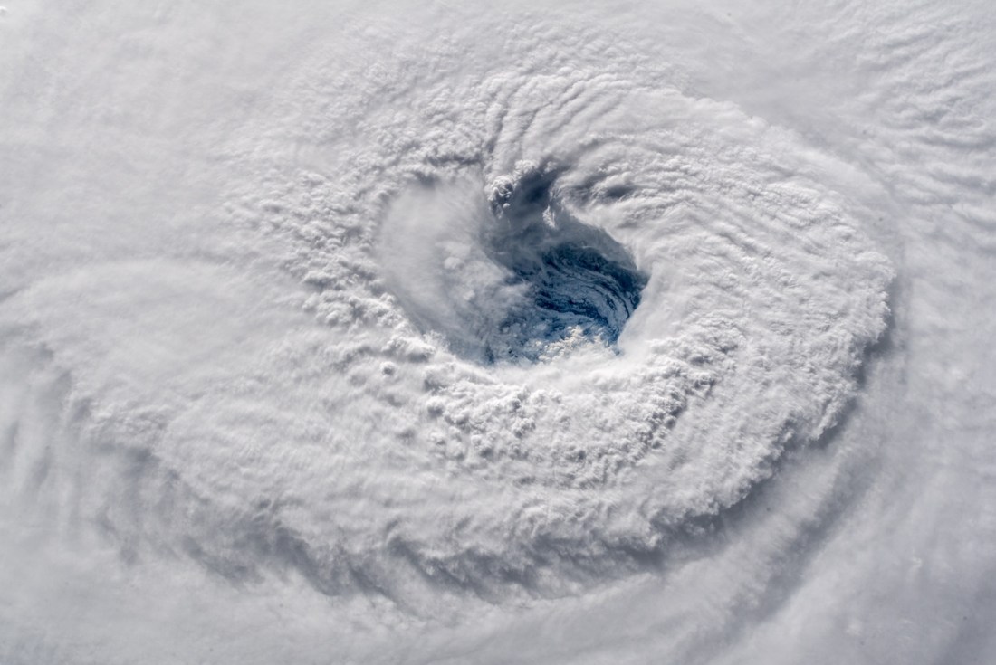
Chilling
That title was the word astronaut Alexander Gerst applied to this view down the throat of powerful Hurricane Florence when the International Space Station flew over the storm this morning.
If you are in the path of this storm, today is the last chance. You’ve probably heard this from everyone else, but just so you’re hearing it everywhere, don’t test this one. This storm is going to be a monster when it makes landfall.
Structures on the barrier islands are going to be devastated by the storm surge and once it hits, it will take days before anyone can get to these islands.
Farther inland, this will be the farthest north that a category 4+ Atlantic hurricane has ever made landfall, bringing winds to areas that haven’t built for them.
Still farther inland, forecasts call for this storm to stall, dumping huge rainfall totals up against the Appalachian Mountains. Those rains will not be able to spread out across the landscape like they did in Texas last year when Harvey dumped comparable rainfall totals on Houston. Instead, the rains from Florence will be funneled into steep channels as they flow out of the high ground, where they will flow rapidly down towards the coastline. They will take bridges with them. They will take roads with them. They will probably take houses and cars with them. They will take boulders with them. If you’re in one of these towns, you will be cut off from assistance by these floodwaters, and if anything goes wrong you will be stuck until the waters recede.
If you haven’t gotten out yet, get out now. Please don’t test this one.
-JBB
Image credit: https://flic.kr/p/2b1mpKn
